
Super Strenuous 85 miles
Hiking time 48:43
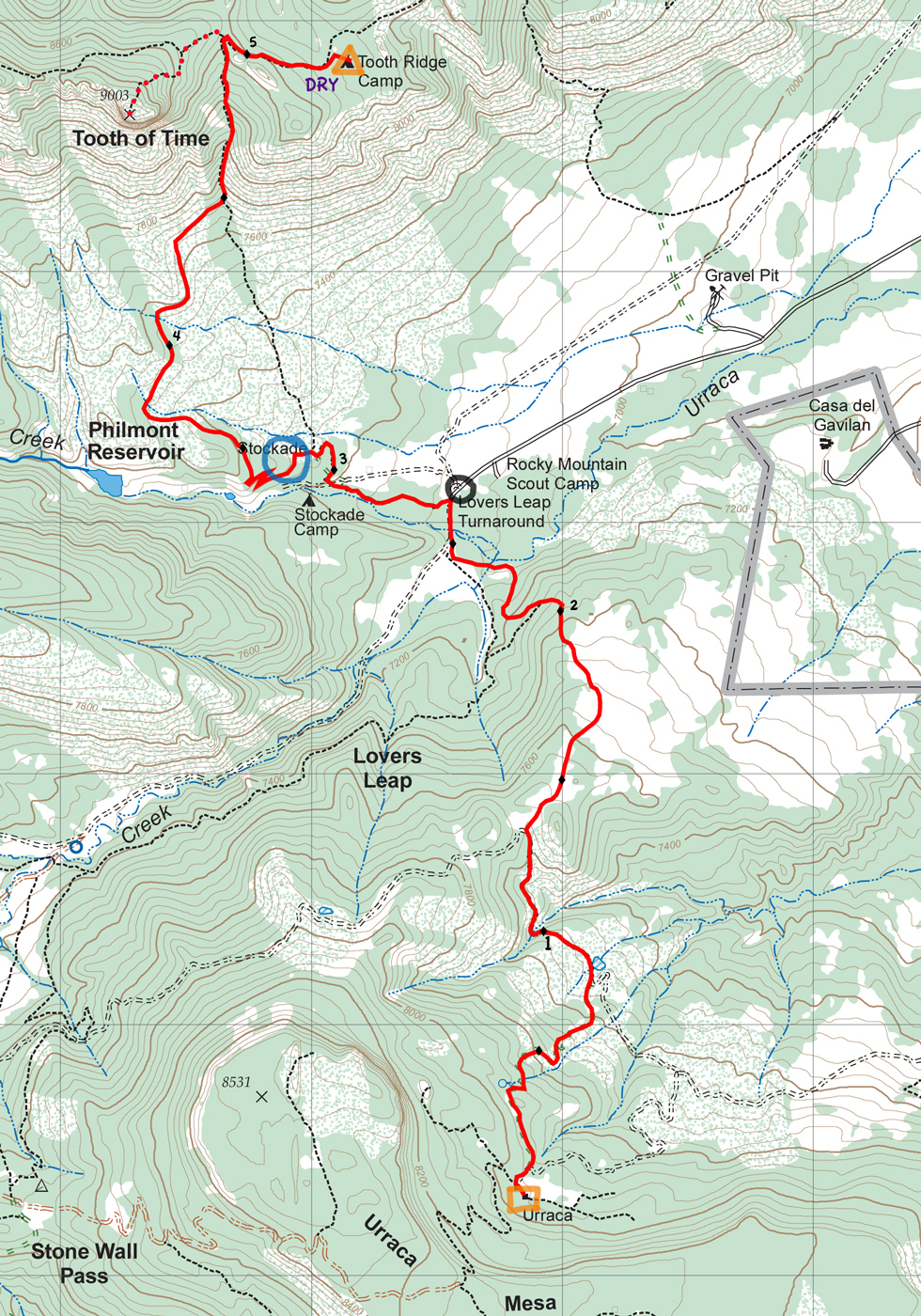
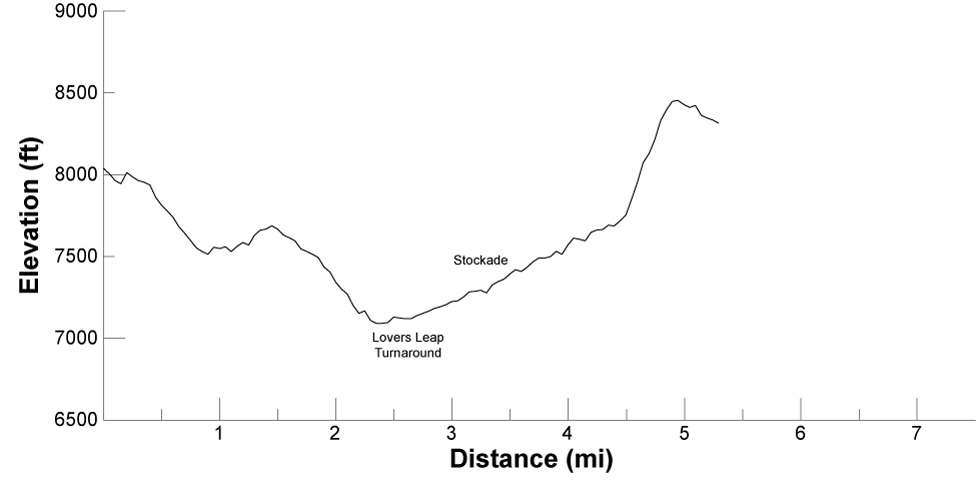
5.3 miles Time: 3:13
Gain: 1,761 ft Loss: 1,485 ft
Follow the out of service road north from Urraca and descend about 1,000 feet over the first 2-1/2 miles to near Lovers Leap Turnaround, picking up the trail continuing north at about 1-1/4 miles as the road turns west. You may be able to see the cliffs of Lovers Leap itself to the southwest along the South Fork Urraca Creek canyon.
Find your way through the confusion of trails near the turnaround along the trail to the west, then north at the 3-mile point to the Stockade. This is the last reliable water before Clarks Fork, so you may want to have dinner here and stock up on water for the climb to the ridge and the next day.
Then start up the ridge. The climb is fairly easy for the next mile or so, but becomes steeper and more challenging between the 4-1/2 and 5-mile points. At 5 miles from Urraca, you top out on the ridge below the Tooth of Time and it's an easy, descending walk to your camp.
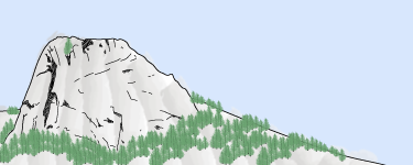
Either that evening or the next morning, you'll want to scramble the 3/4 miles and 400 feet elevation gain from Tooth Ridge Camp to the top of the Tooth of Time for spectacular views in all directions. There are bear cables at the base of the Tooth so you don't have to carry anything extra up.
Tooth Ridge Camp also has "the best seat in the house" — but you'll have to check that out for yourself.
Tooth Ridge Camp is a dry trail camp with excellent views over base camp and on to the plains to the east. Sunrise is spectacular. The nearest water is at the Stockade, 2 miles and 1,000 feet down the ridge to the south.
The Stockade is a "fort" at the base of Tooth Ridge. It's the last water on your way to Tooth Ridge Camp.