
Staffed Camp
Elevation 8,156 ft
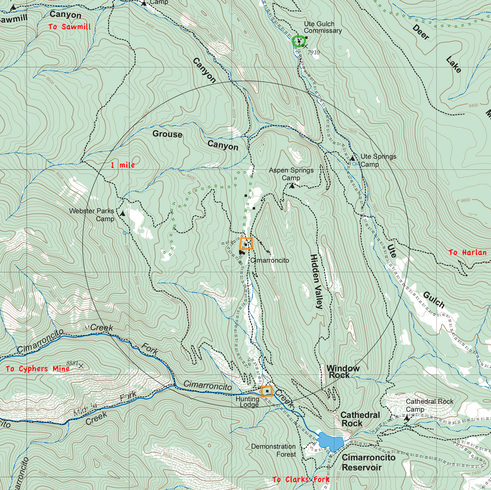
Cimarroncito is located in a broad valley. Most of the campsites are north and west of the main cabin. All are excellent. The rock climbing and rappelling are up the ridge to the east of camp.
Rock climbing, rappellling, and bouldering. Rock climbing and rappelling are extremely weather sensitive: thunderstorms will close down the entire operation. Generally, earlier in the day is more reliable. Showers are generally available.
Purified water is plentiful.
Hunting Lodge is just over a mile to the south.
Head north through Aspen Springs to Ute Gulch Commissary for food pickup, or bear south through Hidden Valley and Window Rock for one of the best hikes at Philmont. South goes to Hunting Lodge and either Clarks Fork (south) or Cyphers Mine (west). Northwest heads toward Sawmill Canyon.
Itinerary 1, day 3
Itinerary 3, day 4*
Itinerary 4, day 9*
Itinerary 7, day 10
Itinerary 11, day 4
Itinerary 13, day 9*
Itinerary 15, day 10*
Itinerary 23, day 10
Itinerary 25, day 6
Itinerary 27, day 10
* Layover at Cimarroncito
Cimarron River - Cimarroncito
Cimarroncito - Cito Turnaround
Cimarroncito - Ponderosa Park
Cimarroncito - Sawmill
Cimarroncito - Shaefers Pass
Cimarroncito - Tooth Ridge
Cimarroncito - Upper Clarks Fork
Cyphers Mine - Cimarroncito
Deer Lake Mesa - Cimarroncito
Devils Wash Basin - Cimarroncito
Harlan - Cimarroncito
Lamberts Mine - Cimarroncito
Lost Gap - Cimarroncito