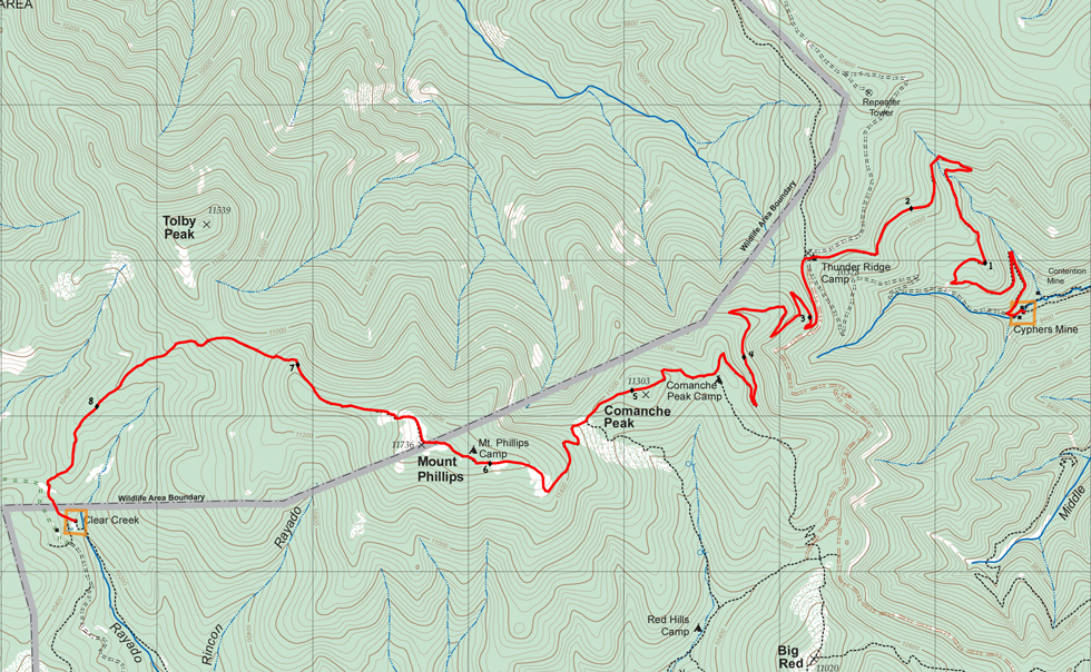

| Distance | 8.62 mi |
| Elevation Gain | 3,128 ft |
| Elevation Loss | 2,190 ft |
| Hiking Time | 5:31 |
| Starting Elevation | 9,367 ft |
| Ending Elevation | 10,305 ft |
| Min Elevation | 9,367 ft |
| Max Elevation | 11,724 ft |
Climb steadily out of Cyphers Mine for 5 miles to the summit of Comanche Peak, gaining about 2,000 feet. From Comanche Peak, walk along the ridge to summit Mt Phillips at about the 6-1/2 mile point and gain another 400 feet (net). From Mt Phillips, descend steeply 2 miles and 1,500 feet to Clear Creek.
Summit Mt Phillips.
Water is available at Cyphers Mine and Clear Creek, but the route in between the two camps is dry.
Itinerary 2 - day 6
Itinerary 25 - day 8
Cyphers Mine: staffed camp with gold panning, mine tour, blacksmithing, and Stomp. (Cold) showers available.
Clear Creek: staffed camp with black powder rifle shooting, tomahawk throwing, and Rocky Mountain Fur Company.