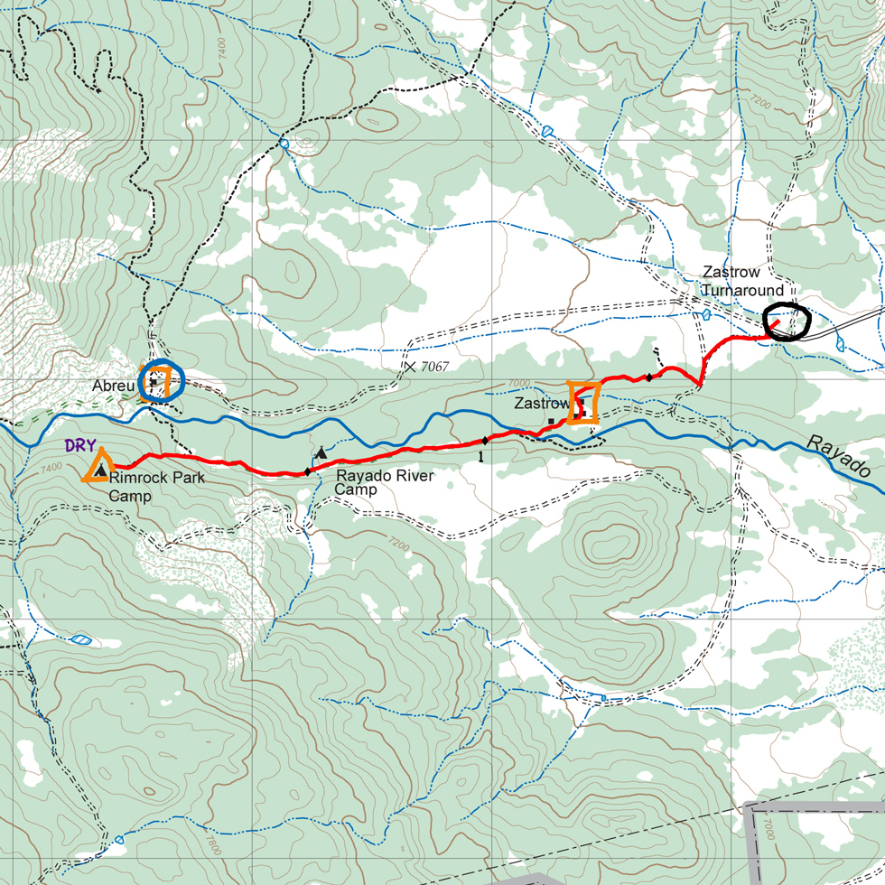

| Distance | 2.07 mi |
| Elevation Gain | 489 ft |
| Elevation Loss | 46 ft |
| Hiking Time | 1:17 |
| Starting Elevation | 6,942 ft |
| Ending Elevation | 7,385 |
| Min Elevation | 6,932 ft |
| Max Elevation | 7,385 ft |
From Zastrow Turnaround, hike southwest along the dirt road for about 1/4-mile and pick up the trail heading west toward Zastrow - about 3/4-mile from your start. Leave Zastrow on the abandoned road to the southwest, cross Rayado Creek shortly before the 1-mile point. At about 1-1/2 miles, you'll pass Rayado River Camp, another ranger training camp (water available). About 1-3/4 miles from your start, the abandoned road turns into a trail and forks: north to Abreu or west to Rimrock Park. From here, climb about 200 feet over 1/4 mile to the camp.
At about 3/4 miles, Zastrow has water and geocaching activities.
Itinerary 32, day 2
Abreu: Mexican homestead, cantina, adobe brick-making, water, showers
Rayado River Camp: ranger training, water
Rimrock Park: ranger training
Zastrow: land navigation, geocaching, water