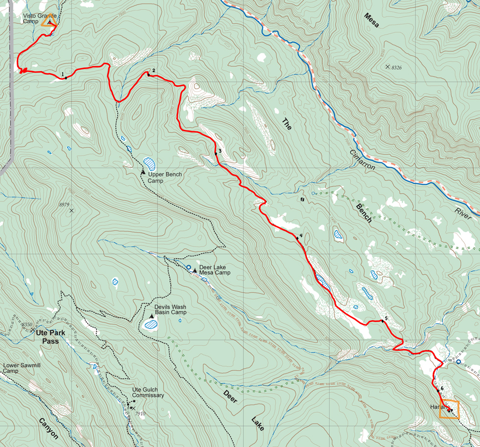

| Distance | 6.17 mi |
| Elevation Gain | 1,318 ft |
| Elevation Loss | 1,446 ft |
| Hiking Time | 3:22 |
| Starting Elevation | 7,713 ft |
| Ending Elevation | 7,585 ft |
| Min Elevation | 7,372 ft |
| Max Elevation | 8,156 ft |
An easy hike that mostly follows the contours around the northeast edge of Deer Lake Mesa. Reach your high point (only 400 feet above the start) about 1-1/2 miles in and gradually work your way down to Harlan.
You'll be hiking under the shadow of Deer Lake Mesa on your right and with occasional views across the Cimarron River to your left.
Wateris available at Visto Grande and Harlan, the hike is dry.
Itinerary 2 - day 3
Visto Grande: trail camp, ranger training.
Harlan: staffed camp with 12-gauge shotgun shooting and reloading, burro racing.